![](/images/other/stat-length.png)
![Randonnée Marche La Possession - Rivière des Galets - Dos d'Ane - Photo](https://media.geolcdn.com/t/1900/400/ext.pjpeg?maxdim=2&url=https%3A%2F%2Fservices.sitytrail.com%2FGeolivesWS%2FDownloadMedia.ashx%3FTrailID%3D381202%26Media%3Db2146de7-968f-4424-9c4e-b2a62bd47053.jpg)
Rivière des Galets - Dos d'Ane
Med974
Utilisateur
![Longueur](/images/other/stat-length.png)
![Altitude max](https://static1.geolcdn.com/siteimages/upload/files/1508320355ic_sort_altitude_max_24dp.png)
![Dénivelé positif](https://static1.geolcdn.com/siteimages/upload/files/1508320355ic_sort_den_pos_24dp.png)
![Km-Effort](/images/other/stat-length.png)
![Altitude min](https://static1.geolcdn.com/siteimages/upload/files/1508320355ic_sort_altitude_min_24dp.png)
![Dénivelé négatif](https://static1.geolcdn.com/siteimages/upload/files/1508320355ic_sort_den_neg_24dp.png)
![Boucle](https://static1.geolcdn.com/siteimages/upload/files/16400158638029165_repeat_loop_refresh_sync_direction_icon.png)
![Marche](https://static1.geolcdn.com/sitytour/trail-icons/101.png)
2h30
Difficulté : Facile
![Scannez ce code QR pour ouvrir la randonnée dans l'application SityTrail](https://capi.geolives.com/qq0zvz2zws4bq2lad0pu/sitytour/trails/381202/qr.png?size=200)
Application GPS de randonnée GRATUITE
À propos
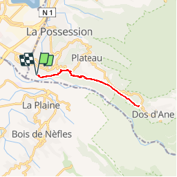
Randonnée Marche de 13,1 km à découvrir à La Réunion, Inconnu, La Possession. Cette randonnée est proposée par Med974.
Description
Départ :
Se rendre dans la rue des Fleurs d'Orangers à la Rivière des Galets et se garer sur la parking du stade.
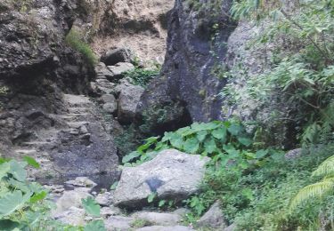
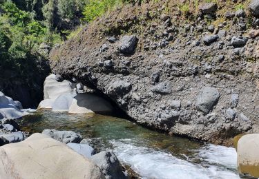
La 1ère partie commence le long de la rivière des galets puis en passant par moment sur du bitume. Le sentier de bord que l'on emprunte est bien indiqué tout au long de la randonnée.
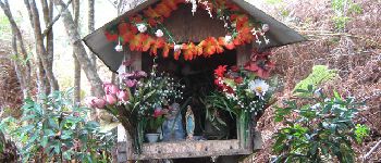
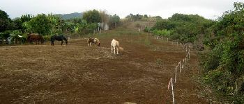
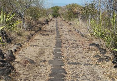
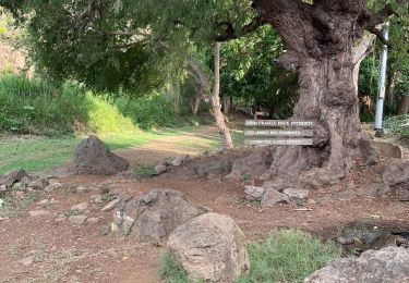
Une fois l'agglomération passée, ce sont les champs de canne qu'il faudra traverser sur une pente identique à la précédente mais avec un petit surplus nature. Le sentier se rapproche du rempart. Plus loin, sur la gauche, les chevaux éparpillés sur leur terre inculte semblent tristes et n'hésitent pas à s'approcher de la clôture. C'est à ce moment qu'ils apprécient les marcheurs qui leur tendent quelques herbes cueillies auparavant. Le sentier est souvent envahi d'herbes de l'autre côté de la clôture mais il est difficile de savoir s'il sera en bon état au moment de la randonnée. Il est de toute manière impossible de se perdre jusqu'au véritable sentier qui rejoint Dos d'Ane de manière fort agréable. A un oratoire, on rencontre une bifurcation vers la gauche qui rejoint la route de Dos d'Ane puis une autre en Y un peu plus loin.
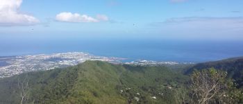
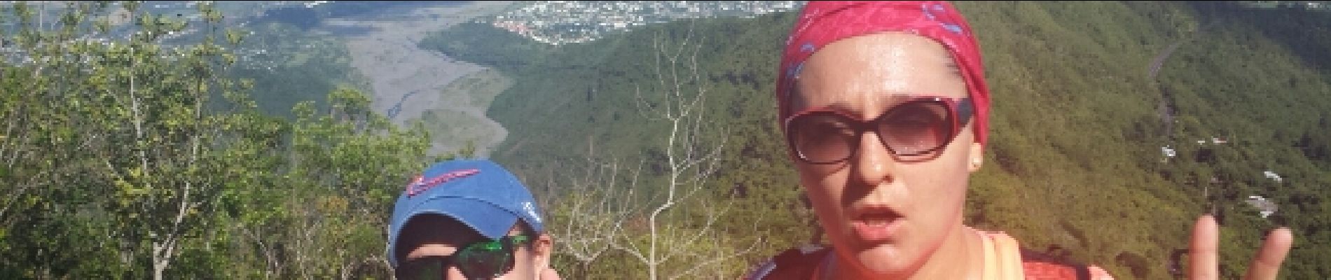
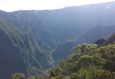
En prenant à gauche, après une montée un peu plus difficile, on se retrouve sur l'aire de départ des parapentes d'où on peut observer en se retournant un beau point de vue sur La Possession - Le Port - La Rivière des Galets (voir photos).
On peut choisir de faire demi-tour ici ou continuer sur la droite pour rejoindre l'église de Dos d'Ane par la route.
Randonnée effectuée le 01/02/2015 sans problèmes.
Sentier en très bon état.
Temps indiqué réalisé en courant sur les parties plates et descentes, voir ici :
http://www.mygeonaute.com/fr-FR/portal/activities/dde915efa6cce5bc915a
Localisation
Commentaires
Randonnées à proximité
![Randonnée Marche Saint-Paul - Sans-Souci vers Maido - Photo](https://media.geolcdn.com/t/375/260/ext.jpg?maxdim=2&url=https%3A%2F%2Fservices.sitytrail.com%2FGeolivesWS%2FDownloadMedia.ashx%3FTrailID%3D329852%26Media%3Dfix__20140728124455.jpg)
![Marche Marche](https://static1.geolcdn.com/sitytour/trail-icons/101.png)
Marche
![](/images/other/stat-length.png)
![](https://static1.geolcdn.com/siteimages/upload/files/16400158638029165_repeat_loop_refresh_sync_direction_icon.png)
![Randonnée Marche Saint-Paul - Le tour de Maison Rouge - Photo](https://media.geolcdn.com/t/375/260/ext.jpg?maxdim=2&url=https%3A%2F%2Fstatic1.geolcdn.com%2Fsiteimages%2Fupload%2Ffiles%2F1553511878bg_sport_marche.png)
![Marche Marche](https://static1.geolcdn.com/sitytour/trail-icons/101.png)
Marche
![](/images/other/stat-length.png)
![](https://static1.geolcdn.com/siteimages/upload/files/16400158638029165_repeat_loop_refresh_sync_direction_icon.png)
![Randonnée Marche Saint-Paul - Canalisation des Orangers - Photo](https://media.geolcdn.com/t/375/260/33548ff9-c104-4aa6-a95a-48c5b3d6dd35.jpg&format=jpg&maxdim=2)
![Marche Marche](https://static1.geolcdn.com/sitytour/trail-icons/101.png)
Marche
![](/images/other/stat-length.png)
![](https://static1.geolcdn.com/siteimages/upload/files/16400158638029165_repeat_loop_refresh_sync_direction_icon.png)
![Randonnée Quad Saint-Paul - rando 3h - Photo](https://media.geolcdn.com/t/375/260/b82bb2ce-fb44-45c0-bd43-45d47b1e12cb.jpg&format=jpg&maxdim=2)
![Quad Quad](https://static1.geolcdn.com/sitytour/trail-icons/404.png)
![Randonnée Marche La Possession - chemin des anglais - Photo](https://media.geolcdn.com/t/375/260/a9970942-5f60-4502-9255-bd733a142b53.jpg&format=jpg&maxdim=2)
![Marche Marche](https://static1.geolcdn.com/sitytour/trail-icons/101.png)
Marche
![](/images/other/stat-length.png)
![](https://static1.geolcdn.com/siteimages/upload/files/16400158638029165_repeat_loop_refresh_sync_direction_icon.png)
![Randonnée Marche Saint-Paul - Sans Souci - Ilet Alcide - Photo](https://media.geolcdn.com/t/375/260/ext.jpg?maxdim=2&url=https%3A%2F%2Fservices.sitytrail.com%2FGeolivesWS%2FDownloadMedia.ashx%3FTrailID%3D398575%26Media%3D4ec3c696-681a-42bb-954b-4e0439706446.jpg)
![Marche Marche](https://static1.geolcdn.com/sitytour/trail-icons/101.png)
Marche
![](/images/other/stat-length.png)
![](https://static1.geolcdn.com/siteimages/upload/files/16400158638029165_repeat_loop_refresh_sync_direction_icon.png)
![Randonnée Marche Saint-Paul - Rando des roches - Photo](https://media.geolcdn.com/t/375/260/6dedfdd5-4719-4e05-80c5-e0d7392cf09b.jpg&format=jpg&maxdim=2)
![Marche Marche](https://static1.geolcdn.com/sitytour/trail-icons/101.png)
Marche
![](/images/other/stat-length.png)
![](https://static1.geolcdn.com/siteimages/upload/files/16400158638029165_repeat_loop_refresh_sync_direction_icon.png)
![Randonnée Marche Saint-Paul - trek 3 joues de la canalisation des orangers à cilaos - Photo](https://media.geolcdn.com/t/375/260/d8b0f6bb-2067-4cf1-8c9a-2562303d5ba4.jpg&format=jpg&maxdim=2)
![Marche Marche](https://static1.geolcdn.com/sitytour/trail-icons/101.png)
Marche
![](/images/other/stat-length.png)
![](https://static1.geolcdn.com/siteimages/upload/files/16400158638029165_repeat_loop_refresh_sync_direction_icon.png)
![Randonnée Marche Saint-Paul - Tour bassin Vital - Photo](https://media.geolcdn.com/t/375/260/b0874385-4373-4975-be41-cd722c8bc2c9.jpg&format=jpg&maxdim=2)
![Marche Marche](https://static1.geolcdn.com/sitytour/trail-icons/101.png)
Marche
![](/images/other/stat-length.png)
![](https://static1.geolcdn.com/siteimages/upload/files/16400158638029165_repeat_loop_refresh_sync_direction_icon.png)